May 18, 2014
Battle Hollow
Victory, WI
My last post left me sitting in wonder, watching two bald eagles dancing in the sky, then flying off in the direction of Battle Isle. Yes, my friends, I am coming. Like you, so many years ago, I am leaving here knowing that I will reach the river today.
%2B-%2BCopy.JPG&container=blogger&gadget=a&rewriteMime=image%2F*) We started the car again, and resumed our trip westward on Hwy 82, stopping along the way to see the markers left behind by C.V. Porter in 1930. The next marker was shortly up the road, on a small turnoff at Anderson Ridge Road, which looks for all practical purposes like you’re pulling off the highway and driving onto someone’s farm. Here, I found Marker 4 in the series, describing the place where Black Hawk’s trail crossed the old Winnebago Trail. This is perhaps of little consequence, except to wonder why the band would not have chosen to follow this well-established trail which lead southwest directly to the banks of the Mississippi River, but rather to continue onward, planning to intercept the river a little ways upstream from Chief Winneshiek’s Village. Chief Winneshiek himself was said to have been absent from his village at the time of Black Hawk’s arrival to the area, on a hunting trip, but there were many at the time who believed Winneshiek was assisting Black Hawk at this time. If so, Winneshiek would have been leading Black Hawk to the difficult-to-reach island directly to the west from where the two trails crossed, and away from the village where soldiers from Fort Crawford had recently visited.
We started the car again, and resumed our trip westward on Hwy 82, stopping along the way to see the markers left behind by C.V. Porter in 1930. The next marker was shortly up the road, on a small turnoff at Anderson Ridge Road, which looks for all practical purposes like you’re pulling off the highway and driving onto someone’s farm. Here, I found Marker 4 in the series, describing the place where Black Hawk’s trail crossed the old Winnebago Trail. This is perhaps of little consequence, except to wonder why the band would not have chosen to follow this well-established trail which lead southwest directly to the banks of the Mississippi River, but rather to continue onward, planning to intercept the river a little ways upstream from Chief Winneshiek’s Village. Chief Winneshiek himself was said to have been absent from his village at the time of Black Hawk’s arrival to the area, on a hunting trip, but there were many at the time who believed Winneshiek was assisting Black Hawk at this time. If so, Winneshiek would have been leading Black Hawk to the difficult-to-reach island directly to the west from where the two trails crossed, and away from the village where soldiers from Fort Crawford had recently visited.
As always, I wanted to experience as closely as possible the actual path taken by the fleeing band. The only clues left are the names of two roads, Blackhawk Avenue and Battle Hollow Road. Under ordinary circumstances, I would give little creditability to the historical accuracy of such place-names, as I have crossed many such roads along the way which had little to do with the actual trail, but in this case, I believe it to be very plausible. A birds-eye view of the region shows that Blackhawk Avenue leads directly into the valley of Battle Hollow Road (though the two are not connected) which leads down to the historically accurate landmarks of Battle Hollow and Battle Bluff. I find every reason to believe this was the exact valley through which Black Hawk’s band toiled on the afternoon of August 1st, 1832.

And so, I drove West on Blackhawk Avenue, past several new construction homes, to an unsatisfying end of hills too tree covered to see anything of relevance. I was, however, able to locate the road identified as ‘Battle Avenue’, but it was little more than a two-track Billy goat trail, and I couldn’t really see the value of driving to the end of that particular bluff, knowing that by this point, the people would have been heading down the hill, and not along the top of the ridge. I turned around and headed back to the highway.
Anyone following Black Hawk’s path, or mine, will now face the same dilemma I faced. My next target area was no more than 200 yards further west than I had just traveled, but to get there I would have to drive around the outside and back up the valley from the River. The choice is to drive back northeast to Red Mound and then West on CTH UU, and south on Hwy 35, or to continue southwest on Hwy 82 all the way to De Soto, then north on Hwy 35. There is no historical argument for either path, except that if taking the northern route along CTH UU it is possible to stop and view Marker Number 5 in the C.V. Porter series. The events described by that marker took place on August 2nd, and so are out of chronological sequence with the events at Battle Isle, but only the truly dedicated need to be that particular about the order in which they view the markers. I also visited this marker on my way to the river, but I will talk about it in a later post, and afterward, I actually turned back and went down Hwy 82 to De Soto to continue my journey.
Driving North on Hwy 35, just past the Village of De Soto, Wisconsin, the main channel of the Mississippi River pours in from the northwest, while the highway continues in a more northerly direction, cutting off a large, low lying bump of land mostly identifiable as ‘Blackhawk Park’. At first, the park appears to be an island, its southern tip pointing severely downriver, though it is not actually an island, but merely a spit of sand and trees oddly attached at the north, forming a great backwater known as De Soto Bay. At the extreme western end of this bulge of land invading the Mississippi River, further north and not visible from the highway, is a long, narrow, curving island somewhat less than a mile in length known as Battle Island.
+-+Copy.JPG)
As always, I wanted to experience as closely as possible the actual path taken by the fleeing band. The only clues left are the names of two roads, Blackhawk Avenue and Battle Hollow Road. Under ordinary circumstances, I would give little creditability to the historical accuracy of such place-names, as I have crossed many such roads along the way which had little to do with the actual trail, but in this case, I believe it to be very plausible. A birds-eye view of the region shows that Blackhawk Avenue leads directly into the valley of Battle Hollow Road (though the two are not connected) which leads down to the historically accurate landmarks of Battle Hollow and Battle Bluff. I find every reason to believe this was the exact valley through which Black Hawk’s band toiled on the afternoon of August 1st, 1832.
Anyone following Black Hawk’s path, or mine, will now face the same dilemma I faced. My next target area was no more than 200 yards further west than I had just traveled, but to get there I would have to drive around the outside and back up the valley from the River. The choice is to drive back northeast to Red Mound and then West on CTH UU, and south on Hwy 35, or to continue southwest on Hwy 82 all the way to De Soto, then north on Hwy 35. There is no historical argument for either path, except that if taking the northern route along CTH UU it is possible to stop and view Marker Number 5 in the C.V. Porter series. The events described by that marker took place on August 2nd, and so are out of chronological sequence with the events at Battle Isle, but only the truly dedicated need to be that particular about the order in which they view the markers. I also visited this marker on my way to the river, but I will talk about it in a later post, and afterward, I actually turned back and went down Hwy 82 to De Soto to continue my journey.
Driving North on Hwy 35, just past the Village of De Soto, Wisconsin, the main channel of the Mississippi River pours in from the northwest, while the highway continues in a more northerly direction, cutting off a large, low lying bump of land mostly identifiable as ‘Blackhawk Park’. At first, the park appears to be an island, its southern tip pointing severely downriver, though it is not actually an island, but merely a spit of sand and trees oddly attached at the north, forming a great backwater known as De Soto Bay. At the extreme western end of this bulge of land invading the Mississippi River, further north and not visible from the highway, is a long, narrow, curving island somewhat less than a mile in length known as Battle Island.


I felt an odd sensation as I drove past the sign that said, ‘Historical Marker ½ Mile on Right’. It was an odd blend of anticipation, regret, excitement, and melancholy all rolled into one. I was approaching the historical marker for The Battle of Bad Axe, which meant I was nearing the end of my journey. I couldn’t resist stopping there to read the signs before moving on. When we pulled in, there was another couple there reading the markers, and I could tell from their lingering presence and somber demeanor that they had more than a passing interest.
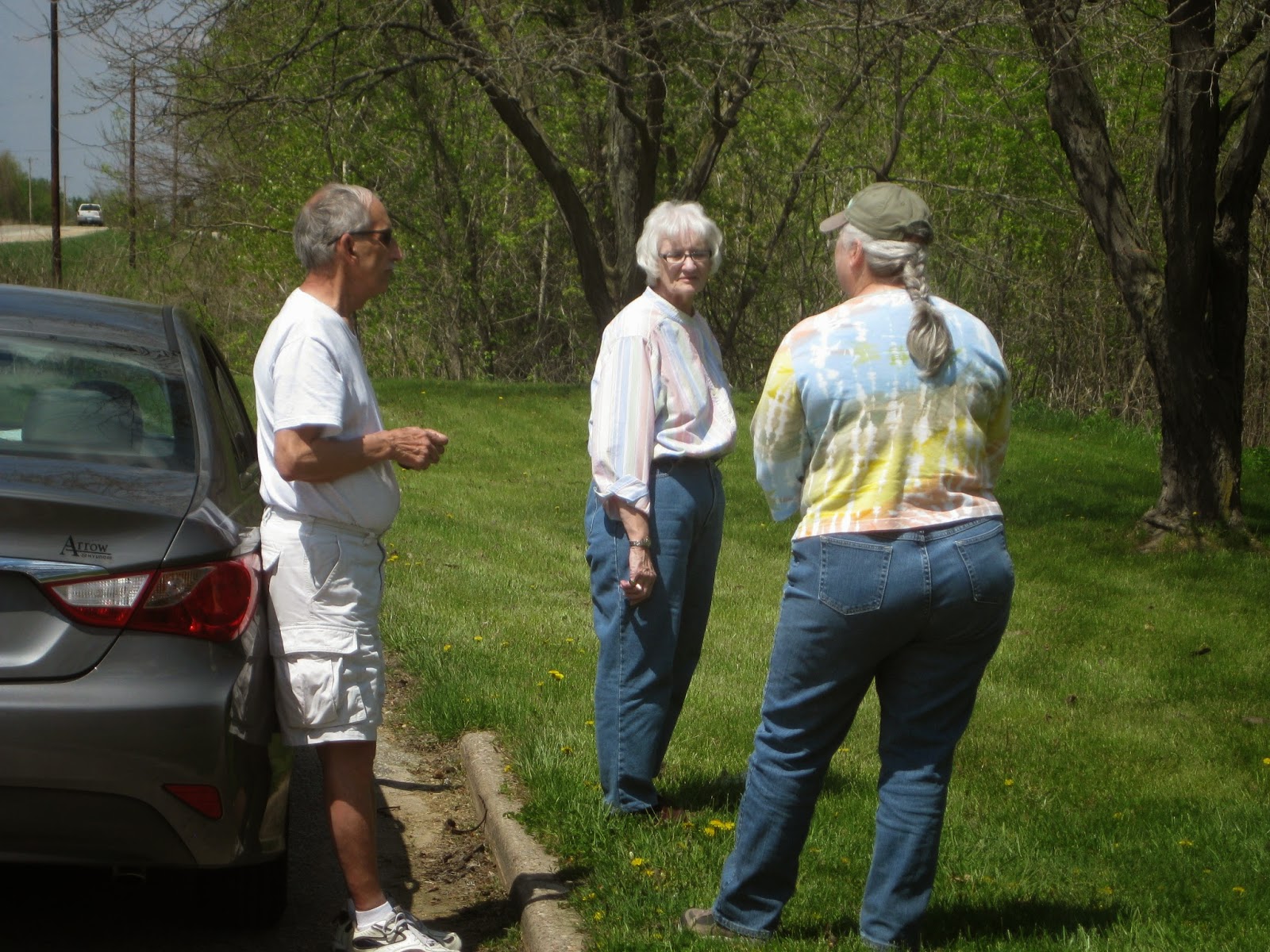

And so I shared with her an abbreviated tale of my journey; how it started in Rock Island and followed the trail past Prophetstown, up to Lake Koshkonong, then Hustisford, Madison, and Wisconsin Heights, on through the Ocooch Mountains, and finally to this very spot. I told them I was almost done, but that I still needed to visit Battle Hollow, and finally Battle Island.
I spoke at length with this couple, and while we spoke my husband went back to the car and began making a prayer stick. As I was finishing my tale, he brought our prayer stick over, and I explained that prayer sticks are a Native American way of offering our prayers to the Great Spirit, God, or Father Creator, whichever name you prefer to use. I explained that each of the objects we place in our prayer sticks has a special prayer. We had the woman tie an item onto the stick with her own private prayer for The People. Her prayer is now part of the healing, which is meant to spread goodness and love in a place that had once been filled with evil and hate. Now she, too, is part of my journey, and a part of the long, slow healing process. Of course, I gave her one of my blog cards, and I’m certain she came online to read some of it. I hope she comes back to see this post. (Welcome my friend. Thank you for your prayer!)

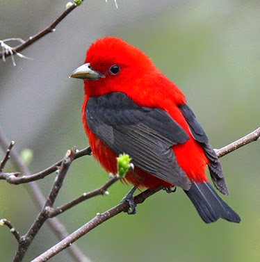
As we drove up the valley, a sudden flash of red and black crossed our path, and I said, “STOP!”
There is a bird that, when in full breeding plumage, makes the American Cardinal seem dull in comparison. The brilliant red hue of the body in contrast with the jet black wings and tail are so startling as to seem unnatural. To my eyes, this is the brightest, truest red hue I have ever seen in all of nature, and it belongs to the male Scarlet Tanager, Piranga olivacea.
In my lifetime, I have seen only four or five of these elusive birds, who are made even more so because they spend almost the entirety of their summer season high in the tree-tops, chortling out their rich, burry songs. Yet even the most persistent tree-top perchers must at times come to earth for water, and alongside the road there was a gentle, trickling brook coming from high up the valley, and meandering down to the Mississippi. Each time I have seen one of these blindingly beautiful birds, it has commemorated a meaningful event in my life, and I have come to see their appearance as a sign of some relevance. When I got out of the car and looked by the brook, I did not see the Tanager. Nevertheless, I was not willing to simply drive away. I felt a tingle in my mind that something was here – something I needed to see or find. We looked – both of us – and took several pictures, but we were never able to determine why we were supposed to stop there. Here are a couple of the shots:
In my lifetime, I have seen only four or five of these elusive birds, who are made even more so because they spend almost the entirety of their summer season high in the tree-tops, chortling out their rich, burry songs. Yet even the most persistent tree-top perchers must at times come to earth for water, and alongside the road there was a gentle, trickling brook coming from high up the valley, and meandering down to the Mississippi. Each time I have seen one of these blindingly beautiful birds, it has commemorated a meaningful event in my life, and I have come to see their appearance as a sign of some relevance. When I got out of the car and looked by the brook, I did not see the Tanager. Nevertheless, I was not willing to simply drive away. I felt a tingle in my mind that something was here – something I needed to see or find. We looked – both of us – and took several pictures, but we were never able to determine why we were supposed to stop there. Here are a couple of the shots:

.JPG)
+-+Copy.JPG)
It was this last view that, upon my return home, made me realize that the place I had stopped – the place where I had been told to stop by the scarlet tananger – was the very site called ‘Battle Hollow’. Though the Indians fled down and through this valley on August 1st unmolested, they returned here on August 2nd to fight one of three final battles in the conflict. I stopped at this location, taking many pictures, without knowing that it was one of my destinations. I am constantly in awe at what I am told, in my heart, when I am willing to listen.
And so, on we drove to the uppermost limits of Battle Hollow Road, eventually turning around when we could drive no further, and I put my mind back in time to the early afternoon of August 1st, 1832, feeling as though seeing the headlong, stumbling, terrified retreat of hundreds of starving refugees, filled with a desperate hope that once again they would reach the river and be able to cross before their enemy could catch them. Onward, down the unfamiliar but promising valley they plunged, each step bringing them closer to their goal. Each step, though they did not know it, bringing them closer to their deaths.
At the mouth of the valley on the north side stands a monolith of a hill called Battle Bluff. Its sides are so severe that only be barest weeds and grasses can survive its southern face, all other vegetation utterly failing on the parched, sandy hillside. When the Indians rounded the base of this austere face, they were now in full view of the Mississippi River, a sight both welcome and frightening. It had been a particularly rainy spring and summer, as wet as the previous year had been dry. The Mississippi River would have been bloated and angry, swallowing the low islands and widening the banks, even as it looked to me now, gazing across the expanse. There would be no easy way through or across, yet this way lay their only hope.
It was here, on the banks of the Mississippi that Black Hawk had a foreboding about the river crossing. Perhaps fearing how many of his weakened people may drown in the crossing attempt, he held a brief council and urged his people to continue north, to ‘get amongst the Winnebagoes’. Most would not listen and began plunging into the river, despite the danger. And so, with feelings of trepidation, Black Hawk chose to stay with his people.
They reached the head of Battle Island by about 3 O’Clock in the afternoon, nearly halfway across the main channel, and immediately started building rafts and flimsy canoes.
.JPG)
As they worked along the shore, cutting trees and fashioning their flotilla, they met a contingency of Ho-Chunk Indians from the Prairie La Crosse band who were on the water, and called to them asking for help in crossing the river. Though the two groups spoke, and no doubt White Cloud fairly pleaded with them for assistance, the Ho-Chunk would not come ashore, and would not help the Sauk, Meskwaki, Kickapoo and Potawatomi refugees. Instead, they continued down the river, eventually passing news of the whereabouts of the band to Indian Agent Joseph Street, down in Fort Crawford in Prairie du Chien.
Disappointed but without options, they resumed their boat-building. Against all odds, and after suffering unimaginably during their flight across the territory, some of the people started floating, or even swimming, across the river. As fast as the rafts could be built, they were piloted to the far shore.
They ran out of time.
The previous evening, a Steam Boat named ‘Warrior’ had been sent by Captain Gustavus Loomis from Prairie du Chien all the way to the Sioux village, at present-day Winona, MN, roughly 20 miles upriver from present-day La Crosse. The Steam Boat had already achieved its mission of sending the Ho-Chunk and all their canoes down the river to Prairie du Chien, and of notifying Souix Chief Wabasha and his warriors of Black Hawk’s approach. Wabasha and about 150 of his warriors headed south at this news, with the intent of helping to prevent Black Hawk’s people from escaping to the west.
The steamship departed later, but passed the Sioux warriors about 15 miles down the river. At 4 ‘clock in the afternoon, the Steam Boat Warrior, piloted by Joseph Throckmorton and under command of Lieutenant James W. Kingsbury, rounded a bend in the river and came upon Black Hawk and his band at the head of Battle Island, the vast majority of whom had not yet been able to cross. Throckmorton had been forewarned by a Sioux traveling by canoe that Black Hawk and his band could be found there, and had stopped to pick up more fuel in readiness for an extended confrontation. The Steam Boat turned and put in anchor, hailing the Indians and asking their identity.
The story of what happened next depends entirely on the perspective of the author of each written account. However, all accounts agree that the two sides spoke to each other, shouting across approximately 50 yards of water. All accounts agree that Black Hawk himself was there, on the island, and at some point hoisted a white flag. All accounts agree that Black Hawk made gesturing motions encouraging the Steam Boat to send over a canoe. All accounts agree that a Winnebago interpreter was on board the Steam Boat, relaying the messages of the Sauk party. All accounts agree that when the smoke cleared a little more than two hours later, upwards of two dozen Indians had been killed, mostly as a result of cannon-fire from the boat.
These agreed-upon observations are what led to the massacre.
According to Black Hawk and several other Indians, who were present on the island and later interviewed, when Black Hawk saw the steam boat setting anchor with solders and a cannon on board, he immediately chose to surrender himself, so as to save the lives of his women, children, young braves, and warriors who were with him. He knew the captain, Throckmorton, personally, and told his warriors not to shoot. He sent for his white flag, and began signaling the boat that he wanted them to send over a canoe, so that he could come on board and shake hands with the soldiers, thus ending the conflict without more loss of life.
While the messenger was gone, searching for his White Flag, Black Hawk took a small piece of white cotton and put it on a pole, indicating that he wanted to surrender.
Black Hawk called out to the boat, in Sauk language, “I am Black Hawk – and I wish to come and shake hands with you…”
A man on board the boat, who spoke Winnebago, asked if there was a Chief among them, or if Black Hawk was there. He was answered by Wawkonchawkoohaw, a nephew of The Prophet, “Yes – Black Hawk and Makatauaquat (Black Cloud) wish to surrender.”
Then the people on the boat asked if they were Winnebagoes or Sauks. Black Hawk told Wawkonchawkoohaw to shout back that they were Sauks, and wanted to give themselves up.
The point-of-view from the boat was entirely different.
This was the first time any of these men had seen Black Hawk, and they did not know him by sight. No pictures existed of him at that time. They believed the fictional propaganda about the great warrior, Black Hawk, and could not so quickly believe that if they were in the presence of the great Black Hawk himself he would not use every dirty trick in the book to gain the advantage. Throckmorton and Kingsbury stated that they believed the appearance of the white flag was a ruse, and that the waving arm motions were simply an attempt to lure the boat closer for a more effective attack. Even so, the entire battle may well have hinged on the words communicated from Black Hawk, to Wawkonchawkoohaw, to the interpreter on board the Warrior, to the Captain and Lieutenant in command. According to Lieutenant Reuben Holmes, when asked if they were Sauk or Winnebago, he was told by the interpreter that they were Winnebagoes, which the steamboat captain knew to be false. If this fact is true, it explains all the distrust, and their reluctance to send a canoe at Black Hawk’s bidding. It does not explain the end result.
It can justifiably be said that the military forces on board the Warrior saw only what they wanted to see, and heard only what they wanted to hear. They could see 150 unarmed Native Americans on the shore, but they were expecting to see 400 or more, and between the trunks of the concealing trees, they believed they saw preparations of muskets by those in hiding. There was a woman on board who knew at least some of the Sauk language, and when she confirmed to the commanders that the Indians were indeed Sauk, Kingsbury ignored the white flag and gave the command to fire, starting with the six-pound cannon. They aimed the cannon into the heart of the biggest collection of Natives on the shore, and laid waste a “straight blanket” of Indians who fell in tatters to the beach. This was followed immediately with a round of musket fire into the helpless, bewildered Indians on the beach, but was answered in kind by the equally distrustful braves who, though ordered not to shoot, had held back in readiness if they themselves were attacked. The cannon fired a second time, laying down another swath of Natives. Then a third time, with similar effect.
That there was not more loss of life is surprising, and attributable to poor weapons, and the fact that just before the cannon was fired, a Winnebago on board the Warrior shouted a warning to those on shore. “Run and Hide! The whites are going to shoot!”
The Indians who survived the first volley ran for the trees, taking cover where they could find it. The Warrior had brought along only three charges of canister shot for the cannon, and so the fighting fell into a contest of small arms fire, which continued for about two hours, ending only when the Warrior fell desperately shy of fuel, and had to break off. Their intent was to go south to Prairie du Chien and refuel, then come back to patrol the river, a round trip of seven hours.
An accurate death toll was never taken, though an estimated 23 to 25 killed on the part of the Indians, with at least as many wounded, has stood through time as the closest guess. Since the most credible account indicated that 23 were buried in one place, it is fair to assume that there were more fatalities – perhaps many more. No one on board the Warrior was killed.
The battle ended sometime before Seven O’clock, about an hour before Atkinson’s weary troops arrived at their campsite nine miles distant. Had they, Atkinson’s troops, arrive sooner, it is likely they would have heard the cannon fire at that range, and then forged ahead, even after their long march, to join the active fighting. As it was, Black Hawk and his people were afforded one more night where they could retreat to the forests and plan for the next day’s run.
Black Hawk now held another emergency council with his people. He told them he intended to abandon the crossing, and instead head north. It was now his plan to bypass the Ho-Chunk Territory and head further north into Chippewa (Ojibwa) country, perhaps all the way to Canada. In the end, only three lodges decided to join Black Hawk in his new flight to the north. With him went Chokepachepaho (Little Stabbing Chief), and Wabokieshiek The Prophet, among others. Black Hawk stated in his autobiography, “After the boat left us, I told my people to cross [the Mississippi], if they could, and wished: that I intended to go to Chippewa country. Some commenced crossing, and such as determined to follow them [across the river] remained – only three lodges going with me.” Black Hawk gathered his wife, Singing Bird, and the three children of his lodge, and with his now tiny group of followers, headed north to seek new lives among the Chippewa.
With this parting, Black Hawk was no longer in command of the several hundred remaining Indians who had followed him to this point. Some chose to plunge immediately into the water and swim across, Pamaho among them, and some continued to build small rafts, slipping into the water and the night to escape. Many more stayed on shore, waiting to cross at first light.
--------------------------------------------------------------------------------------------------------------
I am so bone-weary and exhausted from the emotional toll this journey has had on me that I find it difficult to continue, even though I am so close to the end. I have ranted, I have cursed, I have cried, I have pleaded, and I have prayed. I have questioned the meaning of the word ‘humanity’ and despaired of my own ‘white’ skin, and my European heritage. Worst of all, the death of these 23 or more Indians is but a mild preview of what would occur the next day.
Please allow me to take a moment for myself as I write this…

It is not possible to reach Battle Island by car, even today. The closest you can get is to drive into Blackhawk Park and gaze across the section of the Mississippi River sometimes referred to as ‘Battle Creek’. The location is actually several miles south of the mouth of the Bad Axe River, almost directly across from the Upper Iowa River, but the fighting which took place here during the Black Hawk Conflict of 1832 became known as the Battle of Bad Axe. It was always thought of as a questionable act on the part of the Army and Militia, gathering scant positive publicity in the newspapers, and after 1850, most historians started referring to it as the Bad Axe Massacre.
The Mississippi River is a formidable foe, every bit as deadly as any mounted army. In her black moods, the great muddy waterway can swell to massive proportions, swallowing the low-lying islands and banks, leaving behind a submerged forest whose trunks become an obstacle course of Corinthian columns for the fish, and a Venetian playground for the ducks and gallinules. This was very much how I found it today when I arrived, the road closed due to flooding. A sign pointed the way to the Black Hawk General Store, but the parking lot was underwater, as was the road leading to it. Looking down Violet Rd, we saw a Great Blue Heron standing in the middle of the road, now flooded to a perfect fishing depth of fourteen inches. It is easy to forget, when looking across flooded yards and forests, that the floodwaters are not stagnant pools, but instead continue to flow downstream with all the force of the river, creating unseen hazards and dredging up all the waste and filth we humans tuck away in the woods. As we stood there, a large fish broke the water somewhere to our left, next to someone’s picnic table. It reminded me that when we are gone from this planet, the earth will slowly – eventually – heal herself of our interference.
Makataimeshekiakiak – I am standing in the eye of the hurricane, listening to the silence as death sleeps in the east, marches in from the north, prowls the river to the south, and flows in foreboding silence to the west. They would not let you surrender – they would not let you end the fighting you did not want, and did not start. Now, your enemies have taken even the trust and respect of your people from you. I can picture your face as you slipped away into the darkness - sad, stern, angry. After all your sacrifice and suffering, this was your greatest sorrow.
Be still, oh Spirit of Eternity! Let not the black before dawn become blacker still by day! Let not hate follow hate, and death follow death! Let not this tragedy play through again as it has with all races, and all people, throughout all time! But if it must be so – if I cannot alter the course of the past by wishing it so, then let the retelling of this story serve to heal the scars of my heart and the hearts of The People, and to give wisdom to those who would hear, that someday senseless acts of mass murder will not be carried out by those falsely wearing a badge of righteousness. Let the cycle of violence be ended, someday, let it end. Ah-ho.
(Key Terms: Ma-Ka-Tai-Me-She-Kia-Kiak, Black Sparrow Hawk, Black Hawk, 1767, Saukenuk, Pyesa, Rock Island, Black Hawk’s Watch Tower, Black Hawk State Historic Site, Hauberg Museum, Sauk, Sac, Meskwaki, Fox, Rock River, Sinnissippi River, Mississippi River, War of 1812, British Band, Great Britain, Treaty of 1804, Treaties, Ceded Land, William Henry Harrison, Quashquame, Keokuk, Fort Armstrong, Samuel Whiteside, Black Hawk War of 1832, Black Hawk Conflict, Scalp, Great Sauk Trail, Black Hawk Trail, Prophetstown, Wabokieshiek, White Cloud, The Winnebago Prophet, Ne-o-po-pe, Dixon’s Ferry, Isaiah Stillman, The Battle of Stillman’s Run, Old Man’s Creek, Sycamore Creek, Abraham Lincoln, Chief Shabbona, Felix St. Vrain, Lake Koshkonong, Fort Koshkonong, Fort Atkinson, Henry Atkinson, Andrew Jackson, Lewis Cass, Winfield Scott, Chief Black Wolf, Henry Dodge, James Henry, White Crow, Rock River Rapids, The Four Lakes, Battle of Wisconsin Heights, Benjamin Franklin Smith, Wisconsin River, Kickapoo River, Soldier’s Grove, Steamboat Warrior, Steamship Warrior, Fort Crawford, Battle of Bad Axe, Bad Axe Massacre, Joseph M. Street, Antoine LeClaire, Native American, Indian, Michigan Territory, Indiana Territory, Louisiana Territory, Osage, Souix, Potawatomi, Ojibwe, Ottawa, Ho-Chunk)
No comments:
Post a Comment
Note: Only a member of this blog may post a comment.